Wildfire resilience in power & energy (part 5)
GeoAI for Predictive and Proactive Management

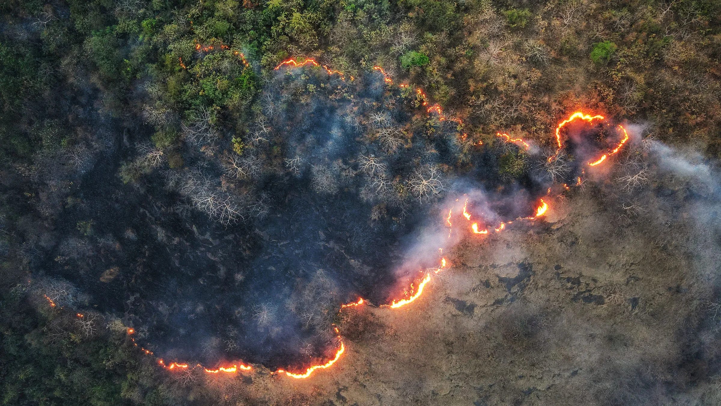
While awareness tells you what's happening now and response manages the immediate aftermath, predictive management aims to prevent the fire from ever starting. In this role, GeoAI evolves from a diagnostic tool into a strategic asset, capable of forecasting ignition points before the first spark.
Quantifying Risk: Probability and Consequence
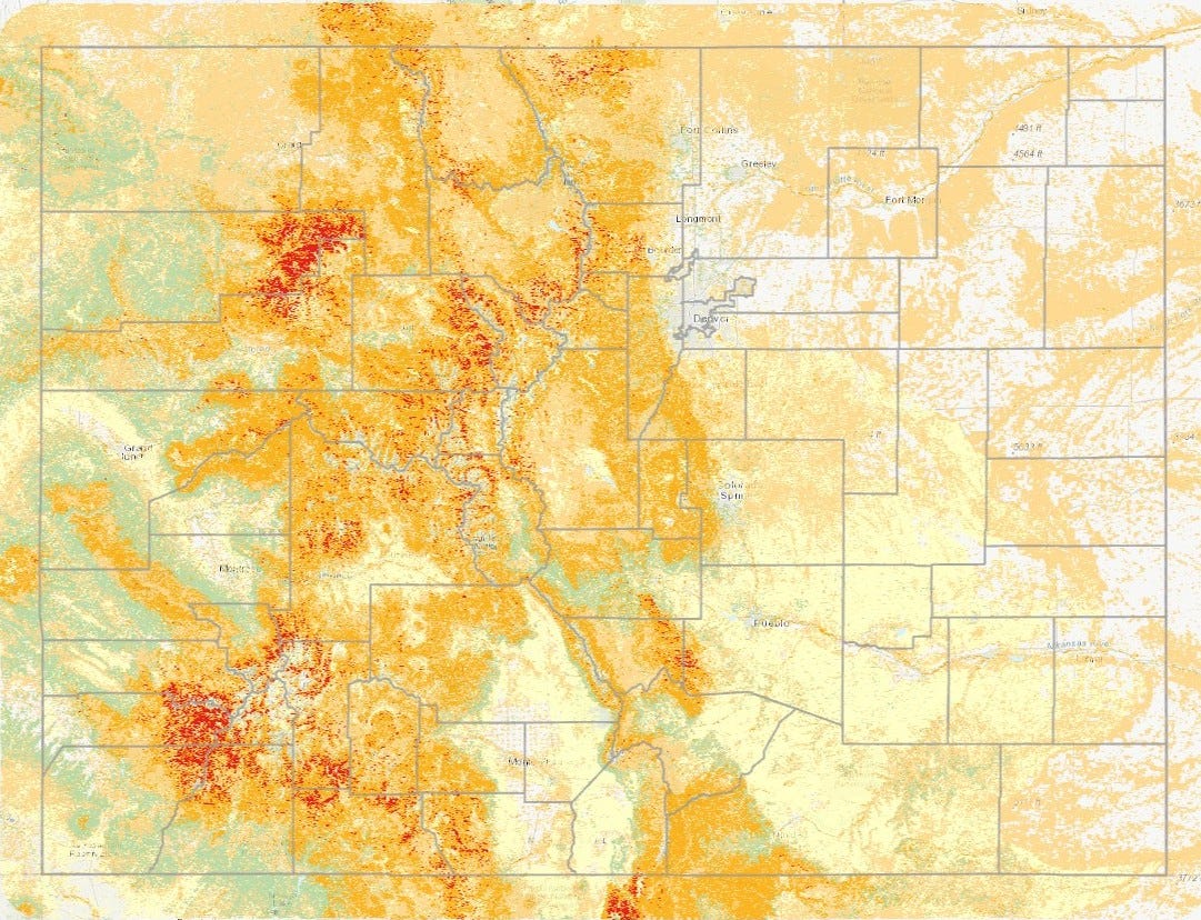
Wildfire risk can be deconstructed into two core components: the Probability of Failure (POF) and the Consequence of Failure (COF).
Probability of Failure (POF) quantifies the likelihood of an ignition event—a power line faulting, a transformer failing, or vegetation igniting. It captures the spark.
Consequence of Failure (COF) assesses the potential impact of that event—the difference between a spark that harmlessly extinguishes and one that escalates into a catastrophic disaster. It measures the fallout.
By mapping both POF and COF, a vague landscape of hazard transforms into a clear, prioritized action plan. The goal is not to create alarm but to provide the clarity needed to intervene decisively where it matters most.
The Dimension of Time
Risk is not a static variable; it evolves over time, often in two distinct ways:
Time-Independent Risk is persistent. A substation adjacent to dense fuel loads represents a constant, unchanging hazard until that vegetation is mitigated.
Time-Dependent Risk is dynamic. A month of drought, a week of extreme heat, and a day of high winds can convert a low-risk area into a critical ignition zone.
This dynamic environment is where GeoAI excels. It doesn't provide a static snapshot; it creates a live, streaming assessment of risk, continuously updated by weather models, sensor data, and environmental changes.
The Algorithm's Advantage
This level of dynamic analysis is where machine learning becomes indispensable. While no human analyst can simultaneously process decades of historical fire data, real-time satellite imagery, and complex weather forecasts, an algorithm can. It systematically identifies critical patterns:
The specific conditions under which ignitions are most likely to occur.
The precise locations where infrastructure vulnerabilities and environmental hazards dangerously overlap.
The subtle precursor signals—such as soil dryness, canopy stress, or sudden weather shifts— that indicate escalating risk.
With each new season and incident, the models learn and refine their accuracy. The system evolves much like a veteran firefighter, but with a crucial difference: it possesses perfect recall, never forgetting a single lesson learned from the data.
From Prediction to Intelligent Action
The actual value of GeoAI lies not in prediction alone, but in its ability to drive intelligent action. It bridges the gap between knowing a risk exists and executing a precise, effective response.
Precision Vegetation Management: Instead of operating on a rigid calendar, crews are deployed where risk is highest. They focus on areas where the algorithm detects rising fuel loads combined with a high probability of ignition, optimizing resources and maximizing impact.
Targeted Inspections: Rather than inspecting thousands of miles of infrastructure on a fixed schedule, crews can prioritize the few hundred miles where risk is currently spiking. This focus shifts resources from rote procedure to proactive problem-solving, catching issues before they become ignition sources.
Dynamic Crew Deployment: Field teams follow dynamic risk maps that update in near real-time. As conditions change or a crew completes a task, the system can immediately redirect them to the next emerging threat, ensuring resources are always positioned for maximum effectiveness.
Strategic Resource Allocation: Budgets and personnel are no longer spread thin across vast territories. Instead, they are concentrated where they can achieve the most significant risk reduction, ensuring every dollar is a calculated investment in resilience.
This represents a shift beyond mere operational efficiency. It fundamentally redefines an organization's relationship with wildfire risk. Instead of reacting to fire as an inevitable force, utilities gain the intelligence to anticipate, mitigate, and control their exposure. This is the transition from being a victim of circumstance to an architect of resilience.
In essence, GeoAI converts wildfire planning from a defensive reaction into a proactive strategy. It allows utilities to move beyond responding to where fires have been and start dictating where fires cannot go. For the first time, organizations can get ahead of the threat, setting the pace and staying one step ahead of the flames.