GeoAI or GeoML? Why the Words We Use Matter
A practical take on precision, perception, and why your kid might actually be smarter than you.

When we talk about "GeoAI," what do we really mean?
The truth is, most of the time we’re not actually talking about artificial general intelligence or even systems that “think.” We’re talking about algorithms that learn from patterns in data—satellite pixels, terrain models, sensor feeds, LiDAR point clouds —and use those patterns to make predictions, classify objects, or detect change. That’s machine learning.
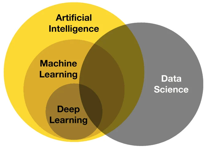
GeoAI is the catchy headline. GeoML is the engine room.
I’d refer to is as the difference between the billboard and the blueprint.
So why does this distinction matter? Because language shapes expectations. “AI” sells a vision of smart systems that do it all. “ML” grounds us in the work it takes to train those systems, tune them, and adapt them to messy, real-world spatial data.
Your audience might hear “AI” and think of magic. The perception of magic could weaken the trust in the system. But those of us building resilient systems — wildfire models, flood prediction tools, vegetation encroachment alerts — know the real magic is in the math, not the mystery.
And sometimes, the clearest insight comes from a 21-year-old calling you out at the dinner table.
GeoML? It’s catchy. I like it
.